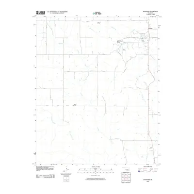
2010 Map of Fittstown
USGS Topo · Published 2010About this map
Fittstown and Franks anchor this portion of Pontotoc County, where the transition from petroleum extraction to water resource management is clearly visible. The northern reaches are defined by the West Fitts Oil Field, while the southern landscape is shaped by the headwaters of the Blue River and several of its tributaries, including Little West Blue Creek. The presence of Byrds Mill Spring and Upper Clear Boggy Number 26 Dam highlights the area's essential role in regional water infrastructure.
Find a feature on this map
34 named features on this map. Tap any name to fly to it.
Don’t see what you’re looking for? This feature index may not catch every label — zoom into the map to look around manually.
Map Details
Editions of this 2010 Fittstown Map
This is the sole edition of this map. No revisions or reprints were ever made.
Other maps of this area

1901 · Stonewall
USGS Topo · 1:125,000

1901 · Tishomingo
USGS Topo · 1:125,000

1957 · Stonewall
USGS Topo · 1:24,000

1957 · Ardmore
USGS Topo · 1:250,000

1963 · Ardmore
USGS Topo · 1:250,000

1963 · Mill Creek
USGS Topo · 1:24,000
1966 · Harden City
USGS Topo · 1:24,000

1967 · Roff South
USGS Topo · 1:24,000

1967 · Ahloso
USGS Topo · 1:24,000

1967 · Connerville
USGS Topo · 1:24,000