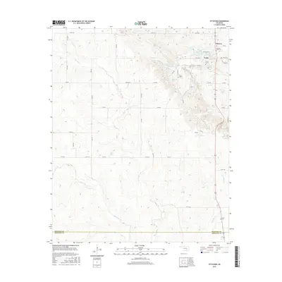
2016 Map of Fittstown
USGS Topo · Published 2016About this map
Blue River and its numerous tributaries, including Little W Blue Cr and Walnut Cr, define the drainage patterns of this landscape southeast of Ada. The settlement of Fittstown serves as a local hub near the northern border, where State Hwy 99 intersects with several county roads. This area is notable for its concentration of small, family-named landmarks and communal burial sites, including Franks Cem, Brown Cem, and the Colley Cem located near the southern border with Johnston County.
Find a feature on this map
39 named features on this map. Tap any name to fly to it.
Don’t see what you’re looking for? This feature index may not catch every label — zoom into the map to look around manually.
Map Details
Editions of this 2016 Fittstown Map
This is the sole edition of this map. No revisions or reprints were ever made.
Other maps of this area

1901 · Stonewall
USGS Topo · 1:125,000

1901 · Tishomingo
USGS Topo · 1:125,000

1957 · Stonewall
USGS Topo · 1:24,000

1957 · Ardmore
USGS Topo · 1:250,000

1963 · Ardmore
USGS Topo · 1:250,000

1963 · Mill Creek
USGS Topo · 1:24,000
1966 · Harden City
USGS Topo · 1:24,000

1967 · Roff South
USGS Topo · 1:24,000

1967 · Ahloso
USGS Topo · 1:24,000

1967 · Connerville
USGS Topo · 1:24,000