2022 Map of Fittstown
USGS Topo · Published 2022About this map
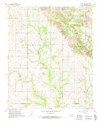
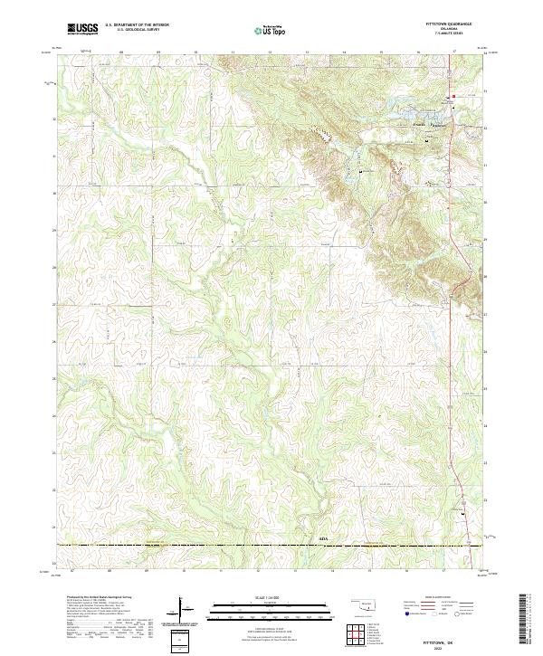
The Blue River and its numerous tributaries, including Little Blue Cr and Mill Cr, define the drainage patterns of this Oklahoma landscape. The small settlement of Fittstown serves as a local focal point near the northern border, situated just east of Franks. This area is characterized by a high density of family and community burial grounds, such as Fittstown Baptist Cem, Franks Cem, and Brown Cem, which provide significant value for genealogical research. The hydrological profile is further detailed by the presence of Byrds Mill Spring and Nichols Lake. The road network consists primarily of county routes like Co RD 1660 and CR 1700, which connect the rural homesteads to the central township. The boundary between Pontotoc County and Johnston County at the southern edge of the sheet indicates the map's position at a significant jurisdictional divide.
Find a feature on this map
41 named features on this map. Tap any name to fly to it.
Don’t see what you’re looking for? This feature index may not catch every label — zoom into the map to look around manually.
Map Details
Editions of this 2022 Fittstown Map
This is the sole edition of this map. No revisions or reprints were ever made.
Historical Maps of Ada Through Time
6 maps found