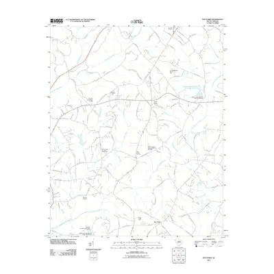
2011 Map of Five Forks
USGS Topo · Published 2011About this map
Five Forks serves as a central point in this landscape defined by the branching tributaries of the Savannah River watershed. The terrain is intricately carved by Eighteenmile Creek to the west and Three and Twenty Creek to the east, creating a network of ridges where local landmarks like Cedar Ridge Farm and several historic burial grounds are situated. Numerous small-scale water management projects are evident through features such as the F Revves Pond Dam and the Clemson University Pond Dam. For genealogists, the map is particularly detailed regarding local interments, noting the Corinth Baptist Cemetery Number Two, Sharon Cemetery, and Willis Chapel Cemetery. The naming conventions of the waterways, including Six and Twenty Creek and Double Branch, reflect the early surveying and pioneering history of this Pickens County region.
Find a feature on this map
125 named features on this map. Tap any name to fly to it.
Don’t see what you’re looking for? This feature index may not catch every label — zoom into the map to look around manually.
Map Details
Editions of this 2011 Five Forks Map
This is the sole edition of this map. No revisions or reprints were ever made.
Other maps of this area

1888 · Pickens
USGS Topo · 1:125,000

1894 · Pickens
USGS Topo · 1:125,000

1950 · La France
USGS Topo · 1:24,000

1951 · La France
USGS Topo · 1:24,000

1951 · Clemson
USGS Topo · 1:24,000

1954 · Greenville
USGS Topo · 1:250,000

1957 · Anderson
USGS Topo · 1:62,500

1957 · Easley
USGS Topo · 1:62,500

1958 · Greenville
USGS Topo · 1:250,000
1961 · Six Mile
USGS Topo · 1:24,000