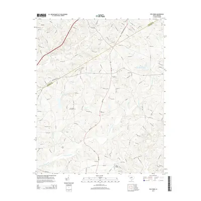
2014 Map of Five Forks
USGS Topo · Published 2014About this map
Norris and the surrounding rural communities are situated along the boundary of Pickens and Anderson Counties during the early 21st century. The landscape is defined by the headwaters of numerous creeks, including Eighteenmile Cr, Cuffie Cr, and the branching Three and Twenty Cr. This network of waterways supported several watershed lakes, most notably Gillespie Lake and Three and Twenty Cr Watershed Five Lake, which provided vital water management for this agricultural and residential region.
Find a feature on this map
128 named features on this map. Tap any name to fly to it.
Don’t see what you’re looking for? This feature index may not catch every label — zoom into the map to look around manually.
Map Details
Editions of this 2014 Five Forks Map
This is the sole edition of this map. No revisions or reprints were ever made.
Other maps of this area

1888 · Pickens
USGS Topo · 1:125,000

1894 · Pickens
USGS Topo · 1:125,000

1950 · La France
USGS Topo · 1:24,000

1951 · La France
USGS Topo · 1:24,000

1951 · Clemson
USGS Topo · 1:24,000

1954 · Greenville
USGS Topo · 1:250,000

1957 · Anderson
USGS Topo · 1:62,500

1957 · Easley
USGS Topo · 1:62,500

1958 · Greenville
USGS Topo · 1:250,000
1961 · Six Mile
USGS Topo · 1:24,000