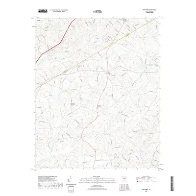
2020 Map of Five Forks
USGS Topo · Published 2020About this map
Norris and the surrounding Upstate landscape occupy this detailed survey along the Pickens Co Anderson Co boundary. The terrain is defined by an intricate network of waterways, including Eighteenmile Cr, Three and Twenty Cr, and Six and Twenty Cr, which carve through the Piedmont hills. This era shows a community deeply rooted in its local institutions, evidenced by numerous burial grounds and congregations such as Willis Chapel Methodist Church Graveyard and Corinth Number Two Baptist Church Graveyard. Genealogists will find significant value in the mapped family-named roads and remote cemeteries like Simpson Cem and Flat Rock Cem. The map captures the interface between small settlements like Five Forks and the rural agricultural lands that have long defined this portion of South Carolina.
Find a feature on this map
131 named features on this map. Tap any name to fly to it.
Don’t see what you’re looking for? This feature index may not catch every label — zoom into the map to look around manually.
Map Details
Editions of this 2020 Five Forks Map
This is the sole edition of this map. No revisions or reprints were ever made.
Other maps of this area

1888 · Pickens
USGS Topo · 1:125,000

1894 · Pickens
USGS Topo · 1:125,000

1950 · La France
USGS Topo · 1:24,000

1951 · La France
USGS Topo · 1:24,000

1951 · Clemson
USGS Topo · 1:24,000

1954 · Greenville
USGS Topo · 1:250,000

1957 · Anderson
USGS Topo · 1:62,500

1957 · Easley
USGS Topo · 1:62,500

1958 · Greenville
USGS Topo · 1:250,000
1961 · Six Mile
USGS Topo · 1:24,000