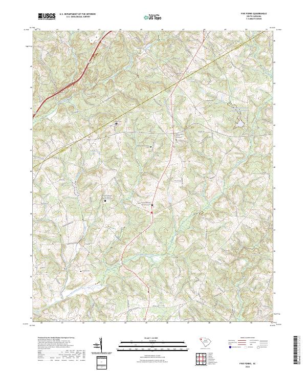
2024 Map of Five Forks
USGS Topo · Published 2024About this map
The rolling landscape of the South Carolina Piedmont is defined here by the converging waters of Eighteenmile Creek and Fifteenmile Creek as they flow south toward the Three and Twenty Creek basin. The terrain is marked by a legacy of family-centered settlement, evidenced by the numerous small burial grounds and rural congregations that anchor the local geography. These include the Fielding Martin Family Cem and the Sharon Cem, alongside larger religious sites like Corinth Number Two Baptist Church and Willis Chapel Methodist Church, each with its associated graveyard.
Find a feature on this map
118 named features on this map. Tap any name to fly to it.
Don’t see what you’re looking for? This feature index may not catch every label — zoom into the map to look around manually.
Map Details
Editions of this 2024 Five Forks Map
This is the sole edition of this map. No revisions or reprints were ever made.
Other maps of this area

1888 · Pickens
USGS Topo · 1:125,000

1894 · Pickens
USGS Topo · 1:125,000

1950 · La France
USGS Topo · 1:24,000

1951 · La France
USGS Topo · 1:24,000

1951 · Clemson
USGS Topo · 1:24,000

1954 · Greenville
USGS Topo · 1:250,000

1957 · Anderson
USGS Topo · 1:62,500

1957 · Easley
USGS Topo · 1:62,500

1958 · Greenville
USGS Topo · 1:250,000
1961 · Six Mile
USGS Topo · 1:24,000