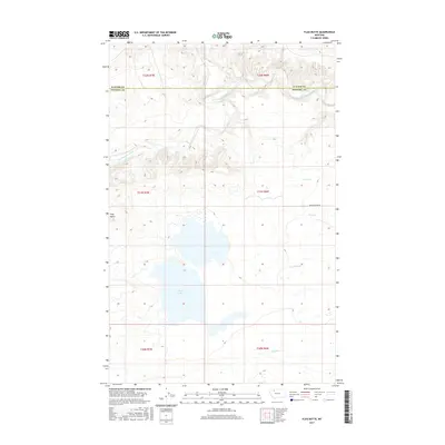
2017 Map of Flag Butte
USGS Topo · Published 2017About this map
Two Medicine River meanders through the northern reaches of this landscape, marking the boundary between Pondera and Glacier counties. This 2017 survey reveals an intricate irrigation system managed through a network of waterways including the N Canal, M Canal, and Two M Canal, which support agricultural activity across the high plains. The terrain is defined by prominent landmarks such as Flag Butte in the west and the expansive Alkali Lake to the south. These features, along with Buffalo Ridge Rd, illustrate the intersection of natural topography and human efforts to harness water in this portion of Montana. The map provides a clear view of the Public Land Survey System grid, including T31N R6W and surrounding townships, which remains foundational to property and land management in the region.
Find a feature on this map
16 named features on this map. Tap any name to fly to it.
Don’t see what you’re looking for? This feature index may not catch every label — zoom into the map to look around manually.
Map Details
Editions of this 2017 Flag Butte Map
This is the sole edition of this map. No revisions or reprints were ever made.
Other maps of this area

1907 · Blackfoot Res.
USGS Topo · 1:48,000

1909 · Cut Bank
USGS Topo · 1:125,000

1911 · Blackfoot
USGS Topo · 1:125,000

1912 · Cut Bank
USGS Topo · 1:125,000

1914 · Heart Butte
USGS Topo · 1:125,000

1918 · Heart Butte
USGS Topo · 1:125,000

1920 · Dupuyer
USGS Topo · 1:125,000

1934 · Lake Frances
USGS Topo · 1:48,000

1937 · Lake Frances
USGS Topo · 1:62,500

1960 · Cut Bank
USGS Topo · 1:250,000