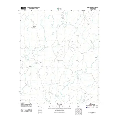
2011 Map of Flag Mountain
USGS Topo · Published 2011About this map
Flag Mountain and its namesake Lookout Tower dominate the northwestern corner of this landscape, marking a prominent peak in the Weogufka Mountains. This area of Coosa County is defined by a dense network of drainages including Hatchet Creek and Weogufka Creek, which cut through the ridges toward the Coosa River basin. Small rural communities like Bentleyville, Moriah, and Lyle are connected by local routes such as County Highway 29 and Lawson Mill Road. Genealogists will find a wealth of local history preserved in the numerous family and community burial grounds, from the O J Mooney Family Cemetery near Mill Creek to the Old Mount Moriah Cemetery and Liberty Hill Cemetery. The map also documents traditional river crossings like Scott Ford and Tyler Ford, indicating historical transportation patterns before modern bridge networks fully transformed the backroads.
Find a feature on this map
44 named features on this map. Tap any name to fly to it.
Don’t see what you’re looking for? This feature index may not catch every label — zoom into the map to look around manually.
Map Details
Editions of this 2011 Flag Mountain Map
This is the sole edition of this map. No revisions or reprints were ever made.
Other maps of this area

1890 · Talladega
USGS Topo · 1:125,000

1892 · Talladega
USGS Topo · 1:125,000

1901 · Wetumpka
USGS Topo · 1:125,000

1903 · Wetumpka
USGS Topo · 1:125,000

1915 · Gantts Quarry
USGS Topo · 1:48,000

1917 · Gantts Quarry
USGS Topo · 1:62,500

1944 · Goodwater
USGS Topo · 1:62,500

1947 · Goodwater
USGS Topo · 1:62,500

1953 · Montgomery
USGS Topo · 1:250,000

1953 · Birmingham
USGS Topo · 1:250,000