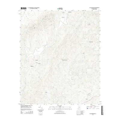
2014 Map of Flag Mountain
USGS Topo · Published 2014About this map
Weogufka Mountains anchor the central terrain of this Coosa County landscape, where the elevation rises to the peak of Flag Mtn in the northwest. This 2014 survey reveals a quiet rural pattern of small settlements such as Moriah, Hillwood, and Lyle, often centered around ancestral burial grounds. The concentration of cemeteries, including the O J Mooney Family Cem and Bell Rattle Cem, indicates a deeply rooted local genealogy tied to the land. Drainage across the region is defined by the winding course of Weogufka Creek and Hatchet Creek, which are fed by numerous small branches like Finikochika Cr and McCutchen Br. The road network, consisting of routes like Al-22 and Newsite Rd, connects these remote hamlets to the broader county, while landmarks like Flint Hill Cem and Mt Moriah Cem serve as enduring markers of the community’s history.
Find a feature on this map
44 named features on this map. Tap any name to fly to it.
Don’t see what you’re looking for? This feature index may not catch every label — zoom into the map to look around manually.
Map Details
Editions of this 2014 Flag Mountain Map
This is the sole edition of this map. No revisions or reprints were ever made.
Other maps of this area

1890 · Talladega
USGS Topo · 1:125,000

1892 · Talladega
USGS Topo · 1:125,000

1901 · Wetumpka
USGS Topo · 1:125,000

1903 · Wetumpka
USGS Topo · 1:125,000

1915 · Gantts Quarry
USGS Topo · 1:48,000

1917 · Gantts Quarry
USGS Topo · 1:62,500

1944 · Goodwater
USGS Topo · 1:62,500

1947 · Goodwater
USGS Topo · 1:62,500

1953 · Montgomery
USGS Topo · 1:250,000

1953 · Birmingham
USGS Topo · 1:250,000