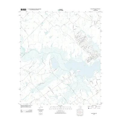
2013 Map of Flag Pond
USGS Topo · Published 2013About this map
Somerville Lake dominates this landscape, its waters reaching into the surrounding terrain via Yegua Cr and Nails Cr. The area is characterized by a high concentration of private water bodies and drainage basins, including Flag Pond and the Schindler Lakes, which suggest a topography defined by low-lying wetlands and managed water resources. Along the southwestern shore, Lake Somerville State Park provides a clear boundary for conservation and recreation in an otherwise rural landscape of family-named roads and remote farm-to-market routes.
Find a feature on this map
103 named features on this map. Tap any name to fly to it.
Don’t see what you’re looking for? This feature index may not catch every label — zoom into the map to look around manually.
Map Details
Editions of this 2013 Flag Pond Map
This is the sole edition of this map. No revisions or reprints were ever made.
Other maps of this area

1919 · Giddings
USGS Topo · 1:62,500

1919 · Dime Box
USGS Topo · 1:62,500

1954 · Austin
USGS Topo · 1:250,000

1956 · Somerville
USGS Topo · 1:62,500

1958 · Ledbetter
USGS Topo · 1:24,000

1958 · Carmine
USGS Topo · 1:24,000

1958 · Burton
USGS Topo · 1:24,000

1959 · Flag Pond
USGS Topo · 1:24,000

1959 · Somerville
USGS Topo · 1:24,000
1959 · Dime Box
USGS Topo · 1:24,000