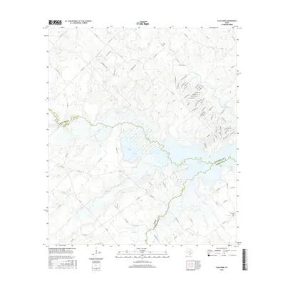
2016 Map of Flag Pond
USGS Topo · Published 2016About this map
Somerville Lake and the marshy expanses of Flag Pond dominate this central Texas landscape at the junction of Lee, Burleson, and Washington Counties. The terrain is defined by a dense network of water bodies, including Schlindler Lake, Edwards Lake, and Bredthauer Lake, which feed into the intricate winding paths of East Yegua Creek and Nails Creek. The map reveals a transition from these low-lying wetlands to upland areas marked by local heritage sites such as Flat Prairie Cem and Birch Cem. A residential cluster near the lake's northern shore features a unique naming convention for its roads, with routes like Blueberry Hill Rd, Cranberry Rd, and Blackberry Rd branching off from St Park Rd 57, illustrating the area's development as a recreational and residential destination near the water.
Find a feature on this map
99 named features on this map. Tap any name to fly to it.
Don’t see what you’re looking for? This feature index may not catch every label — zoom into the map to look around manually.
Map Details
Editions of this 2016 Flag Pond Map
This is the sole edition of this map. No revisions or reprints were ever made.
Other maps of this area

1919 · Giddings
USGS Topo · 1:62,500

1919 · Dime Box
USGS Topo · 1:62,500

1954 · Austin
USGS Topo · 1:250,000

1956 · Somerville
USGS Topo · 1:62,500

1958 · Ledbetter
USGS Topo · 1:24,000

1958 · Carmine
USGS Topo · 1:24,000

1958 · Burton
USGS Topo · 1:24,000

1959 · Flag Pond
USGS Topo · 1:24,000

1959 · Somerville
USGS Topo · 1:24,000
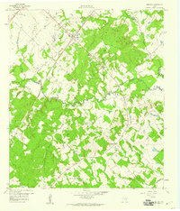
1959 · Dime Box
USGS Topo · 1:24,000