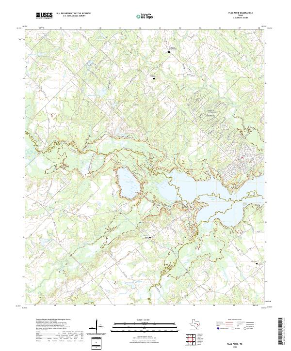
2022 Map of Flag Pond
USGS Topo · Published 2022About this map
Somerville Lake and the marshy expanse of Flag Pond dominate this landscape where Burleson, Lee, and Washington counties meet. The area is defined by its complex hydrology, with Yegua Creek winding through the western portion and several smaller bodies of water like Gerland Lake and Bredthauer Lake dotting the terrain. This map reveals a rural community anchored by its religious and ancestral landmarks, notably the Old Birch Creek Cem and the Saint Marys Baptist Church Cem.
Find a feature on this map
127 named features on this map. Tap any name to fly to it.
Don’t see what you’re looking for? This feature index may not catch every label — zoom into the map to look around manually.
Map Details
Editions of this 2022 Flag Pond Map
This is the sole edition of this map. No revisions or reprints were ever made.
Other maps of this area

1919 · Giddings
USGS Topo · 1:62,500

1919 · Dime Box
USGS Topo · 1:62,500

1954 · Austin
USGS Topo · 1:250,000

1956 · Somerville
USGS Topo · 1:62,500

1958 · Ledbetter
USGS Topo · 1:24,000

1958 · Carmine
USGS Topo · 1:24,000

1958 · Burton
USGS Topo · 1:24,000

1959 · Flag Pond
USGS Topo · 1:24,000

1959 · Somerville
USGS Topo · 1:24,000
1959 · Dime Box
USGS Topo · 1:24,000