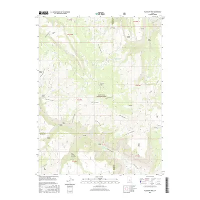
2017 Map of Flagstaff Peak
USGS Topo · Published 2017About this map
Flagstaff Peak and the high elevations of the Wasatch Plateau dominate this 2017 survey of the Manti-LaSal National Forest. Located at the intersection of Sanpete, Emery, and Sevier counties, the landscape is defined by deep drainages and flat-topped ridges. Water management is central to this environment, evidenced by Wrigley Springs Reservoir and the Flagstaff Pipeline cutting through the center of the sheet. The terrain transitions from the high peaks of Ferron Mtn and Dry Mtn down into distinct geological formations like The Box and East Fork Box Canyon. This modern record reveals a network of forest service routes, such as the Muddy Crk N Slope Loop, that provide access to isolated springs including Jason Spring and Birch Spring. The mapping of features like Scab Hollow and Greens Hollow illustrates the complex topography of this Utah mountain range.
Find a feature on this map
58 named features on this map. Tap any name to fly to it.
Don’t see what you’re looking for? This feature index may not catch every label — zoom into the map to look around manually.
Map Details
Editions of this 2017 Flagstaff Peak Map
This is the sole edition of this map. No revisions or reprints were ever made.
Other maps of this area

1885 · Manti
USGS Topo · 1:250,000

1885 · Fish Lake
USGS Topo · 1:250,000

1895 · Manti
USGS Topo · 1:250,000

1896 · Fish Lake
USGS Topo · 1:250,000

1922 · Wasatch
USGS Topo · 1:31,680

1923 · Castle Dale
USGS Topo · 1:62,500

1925 · Castle Dale
USGS Topo · 1:62,500

1925 · Acord Lakes
USGS Topo · 1:62,500

1956 · Salina
USGS Topo · 1:250,000

1956 · Price
USGS Topo · 1:250,000