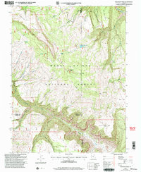
2001 Map of Flagstaff Peak
USGS Topo · Published 2004About this map
Manti-La Sal National Forest dominates this high-altitude landscape where the borders of Sanpete, Emery, and Sevier counties converge. Centered on the prominent summit of Flagstaff Peak, the terrain transitions from the steep escarpments of Ferron Mountain and Dry Mountain into the deep drainage systems of Muddy Creek and Ferron Creek. The presence of a Communication Site atop the peak and a Gravel Pit near Wrigley Spring indicates the intersection of resource management and modern infrastructure in this remote mountainous region during the early 21st century.
Find a feature on this map
36 named features on this map. Tap any name to fly to it.
Don’t see what you’re looking for? This feature index may not catch every label — zoom into the map to look around manually.
Map Details
Editions of this 2001 Flagstaff Peak Map
This is the sole edition of this map. No revisions or reprints were ever made.
Other maps of this area

1885 · Manti
USGS Topo · 1:250,000

1885 · Fish Lake
USGS Topo · 1:250,000

1895 · Manti
USGS Topo · 1:250,000

1896 · Fish Lake
USGS Topo · 1:250,000

1922 · Wasatch
USGS Topo · 1:31,680

1923 · Castle Dale
USGS Topo · 1:62,500

1925 · Castle Dale
USGS Topo · 1:62,500

1925 · Acord Lakes
USGS Topo · 1:62,500

1956 · Salina
USGS Topo · 1:250,000

1956 · Price
USGS Topo · 1:250,000