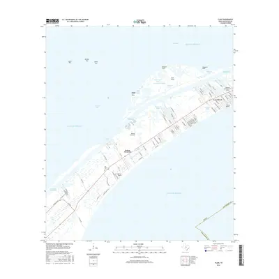
2016 Map of Flake
USGS Topo · Published 2016About this map
Bolivar Peninsula stretches between the Gulf of Mexico and Galveston Bay, providing a detailed view of this coastal landscape as it appeared in 2016. The map documents the residential patterns of communities like Crystal Beach and Bolivar Beach, where a dense network of roads such as Biscayne Beach Blvd and Lagoon Dr serve a population tied closely to the water. The area's maritime and aviation infrastructure is evident, with the Intracostal Waterway cutting behind the peninsula and the Seafood Warehouse Park Airport located near Stingaree Cove.
Find a feature on this map
82 named features on this map. Tap any name to fly to it.
Don’t see what you’re looking for? This feature index may not catch every label — zoom into the map to look around manually.
Map Details
Editions of this 2016 Flake Map
This is the sole edition of this map. No revisions or reprints were ever made.
Other maps of this area

1930 · Galveston
USGS Topo · 1:24,000

1931 · Flake
USGS Topo · 1:24,000

1931 · Frozen Point
USGS Topo · 1:24,000

1932 · Bolivar Point
USGS Topo · 1:24,000

1933 · Frozen Point
USGS Topo · 1:31,680

1933 · Caplen
USGS Topo · 1:31,680

1933 · The Jetties
USGS Topo · 1:31,680

1933 · Whites Lake
USGS Topo · 1:31,680

1933 · Smith Point
USGS Topo · 1:31,680

1933 · Bolivar Point
USGS Topo · 1:31,680