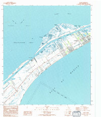
1994 Map of Flake
USGS Topo · Published 1994About this map
Bolivar Peninsula is defined by its precarious position between the Gulf of Mexico and Galveston Bay, showing a landscape of coastal settlement and maritime infrastructure in the late 1980s. The community of Crystal Beach serves as a primary hub, while the interior is marked by the Intracoastal Waterway and a series of protective levees. Local industry and utility are evident through scattered oil wells, Tanks, and a Heliport, contrasting with the natural tidal flats and bayous like Big Elmgrove Bayou. Genealogists and historians can locate the Port Bolivar Cemetery near the settlement of Flake, while surveyors and coastal researchers can trace the Old Railroad Grade and the indefinite Galveston Corporate Boundary crossing the peninsula.
Find a feature on this map
38 named features on this map. Tap any name to fly to it.
Don’t see what you’re looking for? This feature index may not catch every label — zoom into the map to look around manually.
Map Details
Editions of this 1994 Flake Map
This is the sole edition of this map. No revisions or reprints were ever made.
Other maps of this area

1930 · Galveston
USGS Topo · 1:24,000

1931 · Flake
USGS Topo · 1:24,000

1931 · Frozen Point
USGS Topo · 1:24,000

1932 · Bolivar Point
USGS Topo · 1:24,000

1933 · Frozen Point
USGS Topo · 1:31,680

1933 · Caplen
USGS Topo · 1:31,680

1933 · The Jetties
USGS Topo · 1:31,680

1933 · Whites Lake
USGS Topo · 1:31,680

1933 · Smith Point
USGS Topo · 1:31,680

1933 · Bolivar Point
USGS Topo · 1:31,680