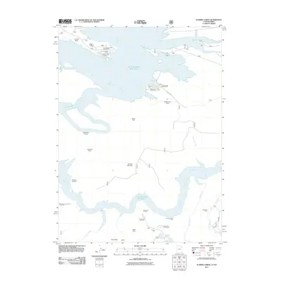
2011 Map of Flaming Gorge
USGS Topo · Published 2011About this map
Flaming Gorge Reservoir dominates the landscape of this Sweetwater County borderlands area, where the high desert meets the deep canyons of the Green River system. The map documents the recreational and residential footprint surrounding the water, particularly at the Lucerne Valley Development and Lucerne Valley Marina. To the south, the terrain rises sharply toward Bare Top Mountain and the high overlooks that define the geological character of the region. The map highlights the contrast between developed access points like the Antelope Flat Campground and the remote, dissected topography of Buck Draw and Hideout Canyon. Land use here is a mix of managed forest land and water-based infrastructure, with landmarks like Red Canyon Overlook and Dowd Mountain Overlook Picnic Area providing vantage points over the massive reservoir.
Find a feature on this map
27 named features on this map. Tap any name to fly to it.
Don’t see what you’re looking for? This feature index may not catch every label — zoom into the map to look around manually.
Map Details
Editions of this 2011 Flaming Gorge Map
This is the sole edition of this map. No revisions or reprints were ever made.
Other maps of this area

1885 · Ashley
USGS Topo · 1:250,000

1906 · Marsh Peak
USGS Topo · 1:125,000

1908 · Marsh Peak
USGS Topo · 1:125,000

1952 · Dutch John Mtn
USGS Topo · 1:24,000

1952 · Flaming Gorge
USGS Topo · 1:24,000

1954 · Vernal
USGS Topo · 1:250,000

1954 · Rock Springs
USGS Topo · 1:250,000

1957 · Currant Creek Ranch
USGS Topo · 1:62,500

1958 · Vernal
USGS Topo · 1:250,000

1958 · Rock Springs
USGS Topo · 1:250,000