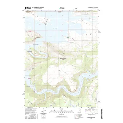
2017 Map of Flaming Gorge
USGS Topo · Published 2017About this map
The Flaming Gorge Reservoir dominates the northern half of this landscape, its waters filling the canyons where the Green River once flowed through the Ashley National Forest. This 2017 survey details a high-elevation environment defined by dramatic elevation changes, from the shores of Linwood Bay and Lucerne Valley up to the high peaks of Bare Top Mtn. The terrain is marked by significant geological formations such as the Boars Tusk and the steep walls of Red Canyon.
Find a feature on this map
40 named features on this map. Tap any name to fly to it.
Don’t see what you’re looking for? This feature index may not catch every label — zoom into the map to look around manually.
Map Details
Editions of this 2017 Flaming Gorge Map
This is the sole edition of this map. No revisions or reprints were ever made.
Other maps of this area

1885 · Ashley
USGS Topo · 1:250,000

1906 · Marsh Peak
USGS Topo · 1:125,000

1908 · Marsh Peak
USGS Topo · 1:125,000

1952 · Dutch John Mtn
USGS Topo · 1:24,000

1952 · Flaming Gorge
USGS Topo · 1:24,000

1954 · Vernal
USGS Topo · 1:250,000

1954 · Rock Springs
USGS Topo · 1:250,000

1957 · Currant Creek Ranch
USGS Topo · 1:62,500

1958 · Vernal
USGS Topo · 1:250,000

1958 · Rock Springs
USGS Topo · 1:250,000