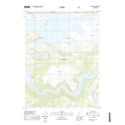
2020 Map of Flaming Gorge
USGS Topo · Published 2020About this map
Ashley National Forest dominates this landscape where the high plateau country of Wyoming meets the canyons of Utah. The waters of Flaming Gorge Reservoir fill the northern half of the sheet, extending into Linwood Bay and the Lucerne Valley near the state line. South of the reservoir, the terrain rises sharply toward Bare Top Mtn and the narrow, winding passage of Red Canyon, where the river once cut deep through the rock before the modern impoundment.
Find a feature on this map
33 named features on this map. Tap any name to fly to it.
Don’t see what you’re looking for? This feature index may not catch every label — zoom into the map to look around manually.
Map Details
Editions of this 2020 Flaming Gorge Map
This is the sole edition of this map. No revisions or reprints were ever made.
Other maps of this area

1885 · Ashley
USGS Topo · 1:250,000

1906 · Marsh Peak
USGS Topo · 1:125,000

1908 · Marsh Peak
USGS Topo · 1:125,000

1952 · Dutch John Mtn
USGS Topo · 1:24,000

1952 · Flaming Gorge
USGS Topo · 1:24,000

1954 · Vernal
USGS Topo · 1:250,000

1954 · Rock Springs
USGS Topo · 1:250,000

1957 · Currant Creek Ranch
USGS Topo · 1:62,500

1958 · Vernal
USGS Topo · 1:250,000

1958 · Rock Springs
USGS Topo · 1:250,000