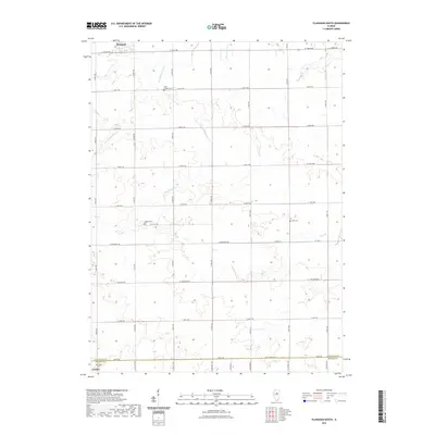
2021 Map of Flanagan South
USGS Topo · Published 2021About this map
Flanagan and Gridley anchor the northern and southern edges of this agricultural landscape along the border of Livingston and McLean Counties. The terrain is defined by a strictly organized section-line road grid, where routes like E 1700 N Rd and N 500 E Rd facilitate transport through the fertile prairie. Winding through this geometry are the natural drainage patterns of Scattering Point Cr, Morehouse Cr, and Pike Cr, which provide the only breaks in the cultivated fields. For those tracing family histories in the area, several local burial grounds are documented, including Saint Josephs Cem and the Waldo Cem. The map illustrates a contemporary rural Illinois environment where historical land divisions remain the primary influence on the modern transportation network and settlement patterns.
Find a feature on this map
38 named features on this map. Tap any name to fly to it.
Don’t see what you’re looking for? This feature index may not catch every label — zoom into the map to look around manually.
Map Details
Editions of this 2021 Flanagan South Map
This is the sole edition of this map. No revisions or reprints were ever made.
Other maps of this area

1926 · Normal
USGS Topo · 1:62,500

1930 · Normal
USGS Topo · 1:62,500

1935 · Pontiac
USGS Topo · 1:62,500

1939 · Pontiac
USGS Topo · 1:62,500

1957 · Colfax
USGS Topo · 1:62,500

1958 · Flanagan
USGS Topo · 1:62,500

1958 · Peoria
USGS Topo · 1:250,000

1961 · Peoria
USGS Topo · 1:250,000

1963 · Peoria
USGS Topo · 1:250,000

1981 · Lexington
USGS Topo · 1:24,000