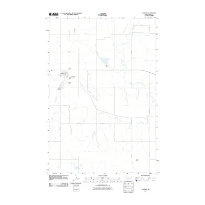
2011 Map of Flasher
USGS Topo · Published 2011About this map
Flasher serves as the primary hub for this portion of Morton County, situated at the intersection of a grid-like network of country roads. The community is anchored by local landmarks including the Flasher Dam and the nearby Hillside Cemetery and Old Fellow Cemetery. The geography is defined by the winding paths of Louise Creek and Chanta Peta Creek, which drain the prairie landscape. To the northeast, the Lake Patricia Dam contains the waters of Lake Patricia, providing a significant water feature in this otherwise semi-arid region. The presence of multiple cemeteries, including Saint Lawrence Cemetery south of town, offers valuable points of reference for genealogists. The terrain is largely open, punctuated by the distinct elevation of Long Butte in the southeast, reflecting the classic topography of the North Dakota plains.
Find a feature on this map
34 named features on this map. Tap any name to fly to it.
Don’t see what you’re looking for? This feature index may not catch every label — zoom into the map to look around manually.
Map Details
Editions of this 2011 Flasher Map
This is the sole edition of this map. No revisions or reprints were ever made.
Other maps of this area

1954 · Bismarck
USGS Topo · 1:250,000

1958 · Bismarck
USGS Topo · 1:250,000

1971 · Timmer
USGS Topo · 1:24,000

1980 · Otter Creek East
USGS Topo · 1:24,000

1980 · Freda
USGS Topo · 1:24,000

1980 · Burgess
USGS Topo · 1:24,000

1980 · Dogtooth Buttes
USGS Topo · 1:24,000

1980 · Raleigh
USGS Topo · 1:24,000

1980 · Nygren Dam
USGS Topo · 1:24,000
1980 · Elgin
USGS Topo · 1:100,000