2024 Map of Flasher
USGS Topo · Published 2024About this map
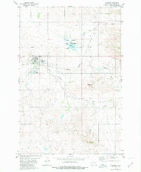
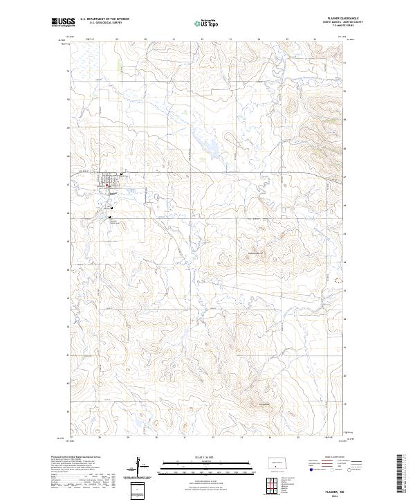
The town of Flasher serves as the central hub of this Morton County landscape, where the residential grid meets the open plains of North Dakota. For genealogists, the map preserves the locations of local burial grounds, including Hillside Cem, Fair Hill Cem, and the Saint Lawrence Catholic Cem. The landscape is defined by its drainages and distinct elevations, with Louise Creek and Chanta Peta Creek winding through the terrain toward the east and south. To the north, the Lake Patricia National Wildlife Refuge provides a significant protected area amid the township and range divisions. The topography is further marked by prominent local heights such as Rattlesnake Hill and Long Butte, which stand out against the agricultural section lines that organize the surrounding countryside.
Find a feature on this map
39 named features on this map. Tap any name to fly to it.
Don’t see what you’re looking for? This feature index may not catch every label — zoom into the map to look around manually.
Map Details
Editions of this 2024 Flasher Map
This is the sole edition of this map. No revisions or reprints were ever made.