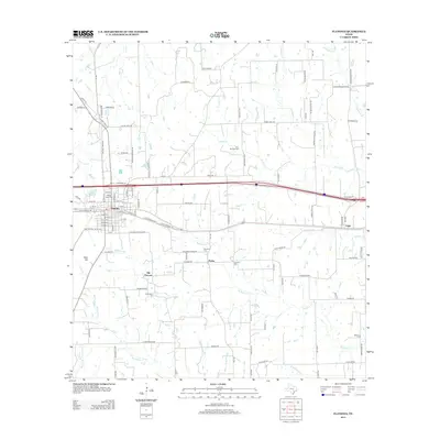
2013 Map of Flatonia
USGS Topo · Published 2013About this map
Flatonia serves as the central hub of this South Texas landscape, where the Up railroad corridor intersects a network of local roads that define the region's agricultural and social character. The transition between Old Flatonia and the contemporary town site reflects the shifts in 19th-century transport, while outlying communities like Praha and Engle maintain their distinct identities through shared landmarks.
Find a feature on this map
113 named features on this map. Tap any name to fly to it.
Don’t see what you’re looking for? This feature index may not catch every label — zoom into the map to look around manually.
Map Details
Editions of this 2013 Flatonia Map
This is the sole edition of this map. No revisions or reprints were ever made.
Other maps of this area

1901 · Flatonia
USGS Topo · 1:125,000

1919 · Schulenburg
USGS Topo · 1:62,500

1953 · Seguin
USGS Topo · 1:250,000

1956 · La Grange
USGS Topo · 1:62,500

1958 · Seguin
USGS Topo · 1:250,000

1965 · Muldoon
USGS Topo · 1:24,000

1965 · Schulenburg
USGS Topo · 1:24,000

1965 · Cistern
USGS Topo · 1:24,000
1965 · Swiss Alp
USGS Topo · 1:24,000

1965 · Komensky
USGS Topo · 1:24,000