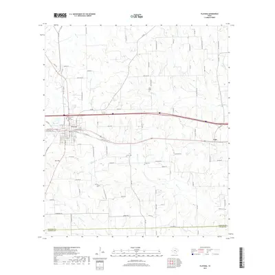
2019 Map of Flatonia
USGS Topo · Published 2019About this map
The town of Flatonia serves as the central hub of this South Texas landscape, where the primary rail and road corridors intersect. Located in Fayette County, the settlement pattern reveals a transition from the structured town grid to more dispersed rural communities like Engle to the east. The genealogy of the area is well-preserved through numerous family and community burial sites, including the Old Flatonia Cem and the Slavonic Cem, reflecting the diverse cultural heritage of the region's early settlers. The terrain is defined by the drainage systems of Mulberry Cr and Big Rocky Cr, which wind through the countryside south of Obar Hill. A network of farm-to-market roads, such as FM 609 and FM 154, connects the outlying agricultural lands to the town center, while features like Ring Lake provide distinct landmarks in the local topography.
Find a feature on this map
101 named features on this map. Tap any name to fly to it.
Don’t see what you’re looking for? This feature index may not catch every label — zoom into the map to look around manually.
Map Details
Editions of this 2019 Flatonia Map
This is the sole edition of this map. No revisions or reprints were ever made.
Other maps of this area

1901 · Flatonia
USGS Topo · 1:125,000

1919 · Schulenburg
USGS Topo · 1:62,500

1953 · Seguin
USGS Topo · 1:250,000

1956 · La Grange
USGS Topo · 1:62,500

1958 · Seguin
USGS Topo · 1:250,000

1965 · Muldoon
USGS Topo · 1:24,000

1965 · Schulenburg
USGS Topo · 1:24,000

1965 · Cistern
USGS Topo · 1:24,000
1965 · Swiss Alp
USGS Topo · 1:24,000

1965 · Komensky
USGS Topo · 1:24,000