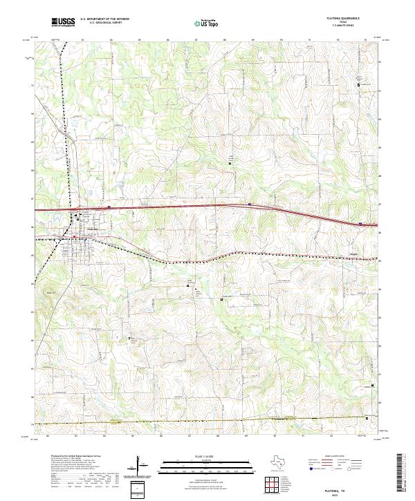
2022 Map of Flatonia
USGS Topo · Published 2022About this map
The town of Flatonia serves as the focal point of this South Texas survey, situated where rail and road infrastructure intersect the rolling landscape of the Fayette-Lavaca county line. The map highlights a significant concentration of burial grounds that reflect the area's diverse cultural heritage, including the Flatonia Cem African American, the Sacred Heart Cem, and the Praha Catholic Cem to the south. Small rural communities like Engle and various family-named landmarks such as Obar Hill dot the terrain, which is drained by a network of waterways including Mulberry Cr, Rocky Cr, and Coldwater Cr. The prominence of the Old Flatonia Cem suggests the shifting center of the community's early settlement history. The landscape is heavily defined by named farm-to-market roads and local lanes, indicating a persistent agricultural and rural residential pattern.
Find a feature on this map
106 named features on this map. Tap any name to fly to it.
Don’t see what you’re looking for? This feature index may not catch every label — zoom into the map to look around manually.
Map Details
Editions of this 2022 Flatonia Map
This is the sole edition of this map. No revisions or reprints were ever made.
Other maps of this area

1901 · Flatonia
USGS Topo · 1:125,000

1919 · Schulenburg
USGS Topo · 1:62,500

1953 · Seguin
USGS Topo · 1:250,000

1956 · La Grange
USGS Topo · 1:62,500

1958 · Seguin
USGS Topo · 1:250,000

1965 · Muldoon
USGS Topo · 1:24,000

1965 · Schulenburg
USGS Topo · 1:24,000

1965 · Cistern
USGS Topo · 1:24,000
1965 · Swiss Alp
USGS Topo · 1:24,000

1965 · Komensky
USGS Topo · 1:24,000