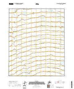
2018 Map of Flaxman Island A-5 SE
USGS Topo · Published 2018About this map
Tundra wetlands and coastal plains define this remote stretch of the North Slope, where the landscape is etched by a complex network of seasonal water bodies and marshes. The map documents a sparsely featured territory divided by Public Land Survey System boundaries including T9n R22e and T8n R22e. Without named settlements or roads, the data highlights the raw hydrography of the region, captured through National Hydrography Dataset surveys. The environment is characterized by low-lying relief and saturated ground, typical of the Arctic coastal reaches within the North Slope Borough. It serves as a stark record of a wilderness area where natural geographic features and administrative grid lines are the primary markers of location.
Find a feature on this map
5 named features on this map. Tap any name to fly to it.
Don’t see what you’re looking for? This feature index may not catch every label — zoom into the map to look around manually.
Map Details
Editions of this 2018 Flaxman Island A-5 SE Map
This is the sole edition of this map. No revisions or reprints were ever made.
Other maps of this area

1951 · Mt. Michelson
USGS Topo · 1:250,000

1955 · Flaxman Island
USGS Topo · 1:250,000

1955 · Mount Michelson D-5
USGS Topo · 1:63,360

1955 · Mount Michelson D-4
USGS Topo · 1:63,360

1955 · Flaxman Island A-5
USGS Topo · 1:63,360

1955 · Flaxman Island A-4
USGS Topo · 1:63,360

1956 · Mt. Michelson
USGS Topo · 1:250,000
1962 · Flaxman Island A-4
USGS Topo · 1:50,000
1962 · Flaxman Island A-5
USGS Topo · 1:50,000
2018 · Flaxman Island A-4 NW
USGS Topo · 1:25,000