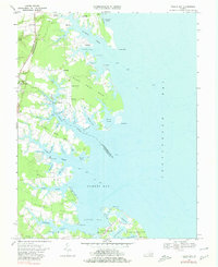
1968 Map of Fleets Bay
USGS Topo · Published 1980About this map
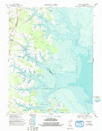
Kilmarnock serves as the inland hub of this coastal landscape, situated near the western edge of a region defined by intricate peninsulas and tidal estuaries. The survey reveals a maritime economy and social structure centered on waterfront access, from the commercial activity at Kilmarnock Wharf to the scattered landings at Highland Landing and Byrdton. The land is divided into named necks such as Bluff Point Neck and Poplar Neck, which are separated by a network of waterways including Indian Creek, Dymer Creek, and Antipoison Creek. Small rural communities are anchored by local institutions like Calvary Ch, Bluff Point Ch, and Maple Grove Ch, while the coast is dotted with navigation aids marked as Light and industrial features like Gravel Pits near Good Luck. This 1968 perspective captures the Northern Neck before modern development altered the traditional patterns of these waterfront settlements.
Find a feature on this map
66 named features on this map. Tap any name to fly to it.
Don’t see what you’re looking for? This feature index may not catch every label — zoom into the map to look around manually.
Map Details
Editions of this 1968 Fleets Bay Map
5 editions found
Other maps of this area

1916 · Kilmarnock
USGS Topo · 1:48,000

1917 · Heathsville
USGS Topo · 1:48,000

1917 · Kilmarnock
USGS Topo · 1:62,500

1917 · Ewell
USGS Topo · 1:62,500

1942 · Kilmarnock
USGS Topo · 1:62,500

1943 · Richmond
USGS Topo · 1:250,000

1944 · Reedville
USGS Topo · 1:31,680

1948 · Deltaville
USGS Topo · 1:24,000
1949 · Irvington
USGS Topo · 1:24,000
1949 · Fleets Bay
USGS Topo · 1:24,000