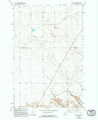
1965 Map of Flick Lake
USGS Topo · Published 1994About this map
The boundary between Chouteau Co and Cascade Co divides this expansive prairie landscape in north-central Montana. The terrain is characterized by the deep, winding incisions of Huntley Coulee and Portage Coulee, which provide the primary drainage for the area. Isolated landmarks such as Whitehorn and Kuich punctuate the high ground, while the eponymous Flick Lake serves as a prominent water feature in the northwest.
Find a feature on this map
11 named features on this map. Tap any name to fly to it.
Don’t see what you’re looking for? This feature index may not catch every label — zoom into the map to look around manually.
Map Details
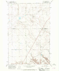
Editions of this 1965 Flick Lake Map
2 editions found
Other maps of this area

1886 · Great Falls
USGS Topo · 1:250,000

1948 · Portage
USGS Topo · 1:62,500

1949 · Portage
USGS Topo · 1:62,500

1949 · Timber Coulee
USGS Topo · 1:62,500

1949 · Great Falls
USGS Topo · 1:62,500

1950 · Timber Coulee
USGS Topo · 1:62,500

1950 · Dent Bridge
USGS Topo · 1:62,500

1951 · Great Falls
USGS Topo · 1:62,500

1954 · Great Falls
USGS Topo · 1:250,000

1957 · Great Falls
USGS Topo · 1:250,000