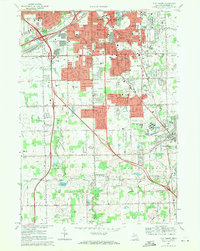
1969 Map of Flint South
USGS Topo · Published 1971About this map
The expanding southern suburbs of Flint and the growing community of Grand Blanc anchor this late-1960s landscape. As the regional industrial hub matured, residential developments pushed south into Mundy and Grand Blanc townships, evidenced by numerous new schools like Bendle High Sch and Ainsworth High Sch. The map reveals a transition from dense urban blocks to a more open, suburban pattern interspersed with essential regional infrastructure, including the Bishop Airport and the large Sewage Disposal plant.
Find a feature on this map
59 named features on this map. Tap any name to fly to it.
Don’t see what you’re looking for? This feature index may not catch every label — zoom into the map to look around manually.
Map Details
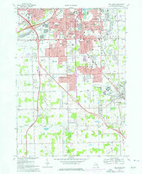
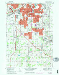
Editions of this 1969 Flint South Map
3 editions found
Other maps of this area

1919 · Burt
USGS Topo · 1:62,500

1920 · Flint
USGS Topo · 1:62,500

1920 · Holly
USGS Topo · 1:62,500

1921 · Burt
USGS Topo · 1:62,500

1922 · Holly
USGS Topo · 1:62,500

1922 · Durand
USGS Topo · 1:62,500

1922 · Flint
USGS Topo · 1:62,500

1943 · Holly
USGS Topo · 1:62,500

1943 · Burt
USGS Topo · 1:62,500

1943 · Durand
USGS Topo · 1:62,500