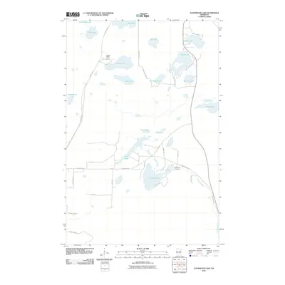
2010 Map of Floodwood Lake
USGS Topo · Published 2010About this map
Floodwood Lake and the Floodwood River anchor this landscape in Saint Louis County, where water dominates the topography. The area is defined by a dense cluster of glacial lakes, including the central Round Lake, the elongated Long Lake, and the eastern Island Lake. The Floodwood Lake Dam regulates the water levels near the intersection of several local routes, while the Gospel Ranch Airport provides a remote point of access north of Beauty Lake.
Find a feature on this map
39 named features on this map. Tap any name to fly to it.
Don’t see what you’re looking for? This feature index may not catch every label — zoom into the map to look around manually.
Map Details
Editions of this 2010 Floodwood Lake Map
This is the sole edition of this map. No revisions or reprints were ever made.
Other maps of this area

1952 · Riley
USGS Topo · 1:24,000

1952 · Silica
USGS Topo · 1:24,000

1952 · Pengilly
USGS Topo · 1:24,000

1954 · Hibbing
USGS Topo · 1:250,000

1957 · Hibbing
USGS Topo · 1:250,000

1958 · Hibbing
USGS Topo · 1:250,000

1963 · Toivola SW
USGS Topo · 1:24,000

1963 · Upstead Lake
USGS Topo · 1:24,000

1964 · Hibbing
USGS Topo · 1:250,000

1969 · Wawina
USGS Topo · 1:24,000