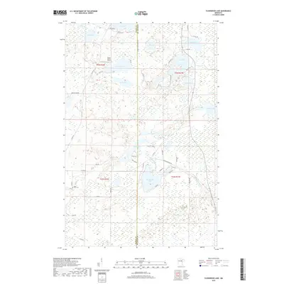
2019 Map of Floodwood Lake
USGS Topo · Published 2019About this map
Floodwood Lake and the meandering Floodwood River dominate this pocket of Northern Minnesota, straddling the border of Itasca and St. Louis counties. The landscape is defined by its glacial hydrology, featuring a dense cluster of water bodies including Island Lake, Beauty Lake, and Merrill Lake. The area reflects a mix of remote wilderness and established rural infrastructure, anchored by the Gospel Ranch Airport and the Maple Grove Cem in the western reaches. Extensive wetlands like the Toivola Swamp illustrate the difficult terrain that shaped local development and road placement. A network of county and township roads, such as County Highway 16 and Wichingen Road, connects the various lakeside properties and residential clusters that have grown around these numerous shorelines.
Find a feature on this map
55 named features on this map. Tap any name to fly to it.
Don’t see what you’re looking for? This feature index may not catch every label — zoom into the map to look around manually.
Map Details
Editions of this 2019 Floodwood Lake Map
This is the sole edition of this map. No revisions or reprints were ever made.
Other maps of this area

1952 · Riley
USGS Topo · 1:24,000

1952 · Silica
USGS Topo · 1:24,000

1952 · Pengilly
USGS Topo · 1:24,000

1954 · Hibbing
USGS Topo · 1:250,000

1957 · Hibbing
USGS Topo · 1:250,000

1958 · Hibbing
USGS Topo · 1:250,000

1963 · Toivola SW
USGS Topo · 1:24,000

1963 · Upstead Lake
USGS Topo · 1:24,000

1964 · Hibbing
USGS Topo · 1:250,000

1969 · Wawina
USGS Topo · 1:24,000