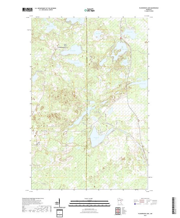
2022 Map of Floodwood Lake
USGS Topo · Published 2022About this map
Floodwood Lake and the meandering Floodwood River dominate this pocket of St. Louis County, where the landscape is defined by an intricate network of glacial lakes and the expansive Toivola Swamp. This 2022 survey captures the transition between Itasca and St. Louis counties, marked by the St Louis-Itasca Judicial Hwy. The area is sparsely settled, with the Gospel Ranch Airport and the Maple Grove Cem serving as primary landmarks for local history and genealogy.
Find a feature on this map
55 named features on this map. Tap any name to fly to it.
Don’t see what you’re looking for? This feature index may not catch every label — zoom into the map to look around manually.
Map Details
Editions of this 2022 Floodwood Lake Map
This is the sole edition of this map. No revisions or reprints were ever made.
Other maps of this area

1952 · Riley
USGS Topo · 1:24,000

1952 · Silica
USGS Topo · 1:24,000

1952 · Pengilly
USGS Topo · 1:24,000

1954 · Hibbing
USGS Topo · 1:250,000

1957 · Hibbing
USGS Topo · 1:250,000

1958 · Hibbing
USGS Topo · 1:250,000

1963 · Toivola SW
USGS Topo · 1:24,000

1963 · Upstead Lake
USGS Topo · 1:24,000

1964 · Hibbing
USGS Topo · 1:250,000

1969 · Wawina
USGS Topo · 1:24,000