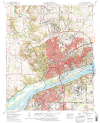
1971 Map of Florence
USGS Topo · Published 1977About this map
Florence and its neighboring river cities are documented here during a period of significant mid-century expansion across the Tennessee River. The landscape is defined by the industrial and academic anchors of the region, including the sprawling campus of Florence State College and the specialized facilities of the National Fertilizer Development Center within the Muscle Shoals Reservation. Settlement patterns show established neighborhoods like East Florence and North Florence alongside newer residential developments such as Sherwood Forest and Alexander Heights. The river remains the central artery for the area, flowing past McFarland Park and around large landmasses like Sevenmile Island and Patton Island. Long-standing transportation corridors are well-defined, from the historic Natchez Trace Parkway to the industrial tracks of the Southern Railway and L & N RR, which served the local economy before the dominance of modern interstate travel.
Find a feature on this map
75 named features on this map. Tap any name to fly to it.
Don’t see what you’re looking for? This feature index may not catch every label — zoom into the map to look around manually.
Map Details
Editions of this 1971 Florence Map
3 editions found
Other maps of this area

1914 · Muscle Shoals
USGS Topo · 1:48,000

1916 · Muscle Shoals
USGS Topo · 1:62,500

1924 · Tuscumbia
USGS Topo · 1:48,000

1924 · Gravelly Springs
USGS Topo · 1:48,000

1925 · Barton
USGS Topo · 1:62,500

1926 · Tuscumbia
USGS Topo · 1:62,500

1926 · Barton
USGS Topo · 1:48,000

1926 · Gravelly Springs
USGS Topo · 1:62,500

1929 · Barton
USGS Topo · 1:62,500

1936 · Pride
USGS Topo · 1:24,000