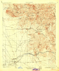
1902 Map of Florence
USGS Topo · Published 1912About this map
The Gila River valley anchors this 1900 survey, revealing the early infrastructure of Pinal County before modern development. The county seat of Florence is the primary hub, flanked by agricultural and ranching outposts like Adamsville and Beaslys Ranch. Irrigation is already a central feature of the landscape, marked by the Casa Grande Canal and the Butte Reservoir Site, reflecting the region's transition into a managed desert environment.
Find a feature on this map
90 named features on this map. Tap any name to fly to it.
Don’t see what you’re looking for? This feature index may not catch every label — zoom into the map to look around manually.
Map Details
Editions of this 1902 Florence Map
5 editions found
Other maps of this area

1900 · Florence
USGS Topo · 1:125,000

1901 · Globe
USGS Topo · 1:62,500

1902 · Globe
USGS Topo · 1:62,500

1902 · Florence
USGS Topo · 1:125,000

1904 · Desert Well
USGS Topo · 1:62,500

1904 · Ft. McDowell
USGS Topo · 1:62,500

1906 · Ft. McDowell
USGS Topo · 1:62,500

1906 · Desert Well
USGS Topo · 1:62,500

1907 · Sacaton
USGS Topo · 1:62,500

1907 · Roosevelt
USGS Topo · 1:125,000