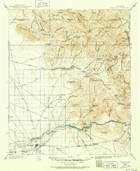
1902 Map of Florence
USGS Topo · Published 1950About this map
Mining operations and cattle ranching dominate this turn-of-the-century Pinal County landscape, anchored by the seat at Florence. The terrain rises sharply from the Gila River valley into the Superstition Mountains and the canyons of the Tonto National Forest. Notable mineral interests are evident at Silver King, the Silver Bell Mine, and the settlement of Reymert, while the Arizona Eastern railroad follows the river through Cochran and Price. This 1902 survey, reprinted in 1950, documents a network of family-named outposts such as Bark's Ranch, Whitfords Ranch, and Donnelly Ranch that served as vital hubs in the high desert. The presence of the Butte Reservoir Site and the Casa Grande Valley canal system illustrates early efforts to manage water for the region's agricultural growth, even as rugged landmarks like Weavers Needle and Picketpost Mt. remained largely untouched by development.
Find a feature on this map
101 named features on this map. Tap any name to fly to it.
Don’t see what you’re looking for? This feature index may not catch every label — zoom into the map to look around manually.
Map Details
Editions of this 1902 Florence Map
5 editions found
Other maps of this area

1900 · Florence
USGS Topo · 1:125,000

1901 · Globe
USGS Topo · 1:62,500

1902 · Globe
USGS Topo · 1:62,500

1902 · Florence
USGS Topo · 1:125,000

1904 · Desert Well
USGS Topo · 1:62,500

1904 · Ft. McDowell
USGS Topo · 1:62,500

1906 · Ft. McDowell
USGS Topo · 1:62,500

1906 · Desert Well
USGS Topo · 1:62,500

1907 · Sacaton
USGS Topo · 1:62,500

1907 · Roosevelt
USGS Topo · 1:125,000