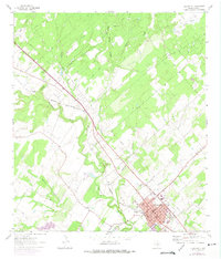
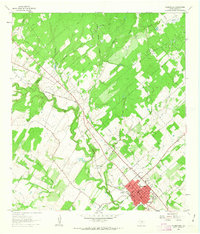
1961 Map of Floresville
USGS Topo · Published 1975About this map
Floresville serves as the focal point of this South Texas landscape, situated where the Southern Pacific railroad corridor meets the winding course of the San Antonio River. The town center is anchored by civic and community landmarks including the Courthouse, Memorial Hospital, and a Jr High Sch. Just to the northwest, the Casa Blanca Historical Marker stands near a sharp bend in the river, signaling the area's deep-rooted ranching and frontier history.
Find a feature on this map
27 named features on this map. Tap any name to fly to it.
Don’t see what you’re looking for? This feature index may not catch every label — zoom into the map to look around manually.
Map Details
Editions of this 1961 Floresville Map
2 editions found
Other maps of this area

1936 · Floresville
USGS Topo · 1:62,500

1953 · Elmendorf
USGS Topo · 1:24,000

1954 · San Antonio
USGS Topo · 1:250,000

1957 · San Antonio
USGS Topo · 1:250,000

1958 · La Vernia SW
USGS Topo · 1:24,000

1958 · Saspamco
USGS Topo · 1:24,000
1961 · Poth
USGS Topo · 1:24,000
1961 · Marcelinas Hills
USGS Topo · 1:24,000
1961 · Dewees
USGS Topo · 1:24,000
1961 · Floresville
USGS Topo · 1:24,000