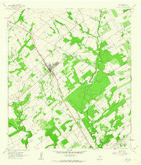
1961 Map of Poth
USGS Topo · Published 1963About this map
Poth stands as a focal point in southern Wilson County during the early 1960s, its town grid tightly clustered along the Southern Pacific railroad line. The landscape is a study in the intersection of traditional agriculture and the burgeoning Texas petroleum industry, evidenced by the Bienek Oil Field to the north and the Falls City Oil Field to the south. The community's social and spiritual centers are clearly marked by the Blessed Sacrament Ch and the Lutheran Cem.
Find a feature on this map
16 named features on this map. Tap any name to fly to it.
Don’t see what you’re looking for? This feature index may not catch every label — zoom into the map to look around manually.
Map Details
Editions of this 1961 Poth Map
2 editions found
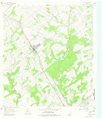
Other maps of this area

1920 · Smiley
USGS Topo · 1:125,000

1925 · Tordia No. 1
USGS Topo · 1:48,000

1931 · Falls City
USGS Topo · 1:62,500

1936 · Floresville
USGS Topo · 1:62,500

1953 · Crystal City
USGS Topo · 1:250,000

1953 · Beeville
USGS Topo · 1:250,000

1953 · Seguin
USGS Topo · 1:250,000

1954 · San Antonio
USGS Topo · 1:250,000

1955 · Crystal City
USGS Topo · 1:250,000

1956 · Beeville
USGS Topo · 1:250,000