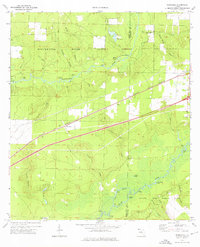
1973 Map of Floridale
USGS Topo · Published 1976About this map
The Blackwater River and Yellow River systems define this 1970s landscape of Santa Rosa and Okaloosa counties, where vast public lands meet local river-bottom history. The northern portion is dominated by the Blackwater River State Forest, containing specific landmarks like the State Fish Hatchery and Riley Bluff. Further south, the map documents the northern reaches of Eglin Air Force Base, including Aux Field No 6.
Find a feature on this map
47 named features on this map. Tap any name to fly to it.
Don’t see what you’re looking for? This feature index may not catch every label — zoom into the map to look around manually.
Map Details
Editions of this 1973 Floridale Map
3 editions found
Other maps of this area

1934 · Holt
USGS Topo · 1:48,000

1934 · Harold
USGS Topo · 1:62,500

1937 · Holt
USGS Topo · 1:62,500

1937 · Harold
USGS Topo · 1:62,500

1938 · Harold
USGS Topo · 1:62,500

1948 · Munson
USGS Topo · 1:62,500

1949 · Crestview
USGS Topo · 1:62,500

1950 · Munson
USGS Topo · 1:62,500

1951 · Crestview
USGS Topo · 1:62,500

1956 · Holt
USGS Topo · 1:62,500