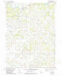
1979 Map of Floris
USGS Topo · Published 1986About this map
The settlement of Floris serves as the central hub of this northern Davis County landscape during the late 1970s. The town's connection to the larger regional economy is defined by the Chicago Rock Island and Pacific railroad, while an Old Railroad Grade to the south indicates changing transportation patterns over time. The terrain is deeply carved by an extensive network of waterways, including Soap Creek, Chequest Creek, and the Fox River, which dictate the placement of rural roads and homesteads.
Find a feature on this map
25 named features on this map. Tap any name to fly to it.
Don’t see what you’re looking for? This feature index may not catch every label — zoom into the map to look around manually.
Map Details
Editions of this 1979 Floris Map
2 editions found
Other maps of this area

1954 · Centerville
USGS Topo · 1:250,000

1956 · Agency
USGS Topo · 1:24,000

1956 · Ottumwa South
USGS Topo · 1:24,000

1956 · Ottumwa South
USGS Topo · 1:62,500

1957 · Centerville
USGS Topo · 1:250,000

1958 · Centerville
USGS Topo · 1:250,000
1965 · Eldon
USGS Topo · 1:24,000

1965 · Selma
USGS Topo · 1:24,000
1970 · Milton
USGS Topo · 1:24,000
1979 · Floris
USGS Topo · 1:24,000