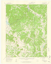
1959 Map of Florissant
USGS Topo · Published 1961About this map
The Pike National Forest dominates this mountain landscape, where the rugged topography of the Front Range meets a legacy of early ranching and recreational expansion. During the late 1950s, the village of Florissant served as a gateway to the Petrified Forest Area, while the South Platte River and its major impoundments, including the Elevenmile Canyon Reservoir and Lake George, defined the region's water resources. Evidence of earlier transportation infrastructure is visible in the Old RR Grade winding through the hills, a remnant of the Midland Terminal Railway that once connected the mining districts to the west.
Find a feature on this map
73 named features on this map. Tap any name to fly to it.
Don’t see what you’re looking for? This feature index may not catch every label — zoom into the map to look around manually.
Map Details
Editions of this 1959 Florissant Map
4 editions found
Other maps of this area

1893 · Platte Canyon
USGS Topo · 1:125,000

1894 · Pikes Peak
USGS Topo · 1:125,000

1901 · Pikes Peak
USGS Topo · 1:125,000

1901 · Pikes Peak
USGS Topo · 1:62,500

1942 · Cover Mtn.
USGS Topo · 1:62,500

1948 · Cover Mtn.
USGS Topo · 1:62,500

1951 · Cripple Creek South
USGS Topo · 1:24,000

1951 · Cripple Creek North
USGS Topo · 1:24,000

1953 · Denver
USGS Topo · 1:250,000

1954 · Signal Butte
USGS Topo · 1:24,000