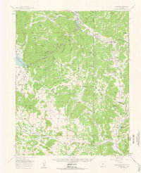
1959 Map of Florissant
USGS Topo · Published 1963About this map
Pike National Forest dominates much of this landscape, where the South Platte River winds through deep canyons and wide parks. In the late 1950s, the area around Florissant and Lake George remained a mosaic of family-held ranchlands, with numerous operations like Lewis Ranch, Abell Ranch, and Witcher Ranch established along the drainage of Fourmile Creek. The mapping reveals the transition of the land from traditional agricultural use to recreational and conservation interests, evidenced by the presence of Camp Alexander and the sprawling Elevenmile Canyon Reservoir. Geological curiosities and local landmarks are carefully noted, including the iconic Balanced Rock and the high point of Crystal Peak. This survey also documents the lingering footprint of early transport infrastructure, such as the Old RR Grade cutting through the valley near the South Platte.
Find a feature on this map
66 named features on this map. Tap any name to fly to it.
Don’t see what you’re looking for? This feature index may not catch every label — zoom into the map to look around manually.
Map Details
Editions of this 1959 Florissant Map
4 editions found
Other maps of this area

1893 · Platte Canyon
USGS Topo · 1:125,000

1894 · Pikes Peak
USGS Topo · 1:125,000

1901 · Pikes Peak
USGS Topo · 1:125,000

1901 · Pikes Peak
USGS Topo · 1:62,500

1942 · Cover Mtn.
USGS Topo · 1:62,500

1948 · Cover Mtn.
USGS Topo · 1:62,500

1951 · Cripple Creek South
USGS Topo · 1:24,000

1951 · Cripple Creek North
USGS Topo · 1:24,000

1953 · Denver
USGS Topo · 1:250,000

1954 · Signal Butte
USGS Topo · 1:24,000