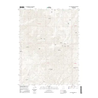
2017 Map of Floy Canyon North
USGS Topo · Published 2017About this map
Steer Ridge and Wagon Road Ridge define the high elevations of this Grand County terrain, where a complex network of canyons drains toward the south. The landscape is marked by numerous water sources critical for high-desert navigation, including Weaver Reservoir in the north and several named springs such as Wilcox Spring, Pioche Spring, and Red Spring. The topographic detail reveals the intricate branching of Tusher Canyon and Floy Canyon, including their various forks and side drainages like Wildcow Canyon and Jennie Canyon. Notable landmarks such as Roan Peaks and Mormon Ridge provide clear navigational points across the township and range lines. The presence of Showerbath Spring within Showerbath Canyon suggests a long-standing reliance on these localized water points in an otherwise arid environment.
Find a feature on this map
37 named features on this map. Tap any name to fly to it.
Don’t see what you’re looking for? This feature index may not catch every label — zoom into the map to look around manually.
Map Details
Editions of this 2017 Floy Canyon North Map
This is the sole edition of this map. No revisions or reprints were ever made.
Other maps of this area

1885 · East Tavaputs
USGS Topo · 1:250,000

1956 · Grand Junction
USGS Topo · 1:250,000

1959 · Grand Junction
USGS Topo · 1:250,000

1960 · Grand Junction
USGS Topo · 1:250,000

1962 · Grand Junction
USGS Topo · 1:250,000

1963 · Tenmile Canyon
USGS Topo · 1:62,500

1963 · Moonwater Point
USGS Topo · 1:62,500
1963 · Floy Canyon
USGS Topo · 1:62,500

1963 · Sego Canyon
USGS Topo · 1:62,500

1964 · Grand Junction
USGS Topo · 1:250,000