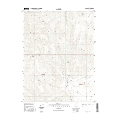
2017 Map of Flume Canyon
USGS Topo · Published 2017About this map
The Book Cliffs dominate the southern portion of this landscape, creating a dramatic geological transition toward the Grand Valley at the bottom of the map. This 2017 survey shows a complex drainage system defined by deep incisions like Flume Canyon, Coal Canyon, and Spring Canyon, which cut through the high plateau. These features reveal the intricate topography of eastern Grand County, where water management is crucial as evidenced by the presence of Oak Springs and Cato Springs.
Find a feature on this map
21 named features on this map. Tap any name to fly to it.
Don’t see what you’re looking for? This feature index may not catch every label — zoom into the map to look around manually.
Map Details
Editions of this 2017 Flume Canyon Map
This is the sole edition of this map. No revisions or reprints were ever made.
Other maps of this area

1885 · East Tavaputs
USGS Topo · 1:250,000

1956 · Grand Junction
USGS Topo · 1:250,000

1959 · Grand Junction
USGS Topo · 1:250,000

1960 · Grand Junction
USGS Topo · 1:250,000

1962 · Grand Junction
USGS Topo · 1:250,000

1963 · Tenmile Canyon
USGS Topo · 1:62,500

1963 · Sego Canyon
USGS Topo · 1:62,500

1964 · Grand Junction
USGS Topo · 1:250,000

1965 · Grand Junction
USGS Topo · 1:250,000

1970 · Flume Canyon
USGS Topo · 1:24,000