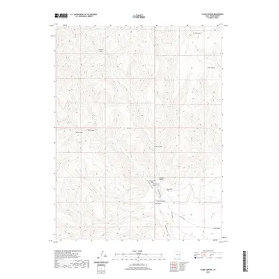
2020 Map of Flume Canyon
USGS Topo · Published 2020About this map
Book Cliffs dominate this portion of Grand County, Utah, where a series of deep drainage systems carve through the high plateau. The network of canyons including Flume Canyon, Cottonwood Canyon, and Diamond Canyon illustrates the complex erosion patterns characteristic of the region. Local water sources like Oak Springs and Cato Springs are critical landmarks in this arid landscape, often determining the placement of early routes such as the Cottonwood Rd. At the southern edge of the survey, the land descends into the Grand Valley, while to the north, narrow passages like Antone Canyon and Halfway Canyon mark the rugged interior. This map is particularly valuable for tracing the physical geography and established access roads like Diamond Canyon Rd that connect these remote canyon floors to the broader valley below.
Find a feature on this map
19 named features on this map. Tap any name to fly to it.
Don’t see what you’re looking for? This feature index may not catch every label — zoom into the map to look around manually.
Map Details
Editions of this 2020 Flume Canyon Map
This is the sole edition of this map. No revisions or reprints were ever made.
Other maps of this area

1885 · East Tavaputs
USGS Topo · 1:250,000

1956 · Grand Junction
USGS Topo · 1:250,000

1959 · Grand Junction
USGS Topo · 1:250,000

1960 · Grand Junction
USGS Topo · 1:250,000

1962 · Grand Junction
USGS Topo · 1:250,000

1963 · Tenmile Canyon
USGS Topo · 1:62,500

1963 · Sego Canyon
USGS Topo · 1:62,500

1964 · Grand Junction
USGS Topo · 1:250,000

1965 · Grand Junction
USGS Topo · 1:250,000

1970 · Flume Canyon
USGS Topo · 1:24,000