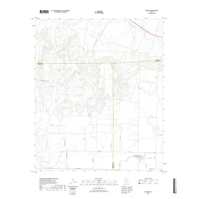
2019 Map of Fluvanna
USGS Topo · Published 2019About this map
Fluvanna sits at the intersection of rural Scurry, Borden, and Garza counties, marking a point where the high plains break into the canyon systems of the West Texas Escarpment. The town's grid remains clear along 9th St and Beech St, while the nearby Fluvanna Cem serves as a primary point of interest for genealogists tracing local families. The landscape is defined by the sharp transition from agricultural fields to the intricate drainages of Gopher Creek and Sand Creek. Water management is central to the area's geography, evidenced by several catchments including Jones Reservoir and the Red Canyon Reservoir. These features, along with a network of rural roads like One Mile Rd and Opossum Hollow Rd, reveal the persistent structure of a cattle and farming community that has adapted to the challenging terrain of the Rolling Plains.
Find a feature on this map
35 named features on this map. Tap any name to fly to it.
Don’t see what you’re looking for? This feature index may not catch every label — zoom into the map to look around manually.
Map Details
Editions of this 2019 Fluvanna Map
This is the sole edition of this map. No revisions or reprints were ever made.
Other maps of this area

1954 · Dermott
USGS Topo · 1:24,000

1954 · Lubbock
USGS Topo · 1:250,000

1954 · Big Spring
USGS Topo · 1:250,000

1958 · Big Spring
USGS Topo · 1:250,000

1969 · Gail NE
USGS Topo · 1:24,000

1969 · Arah
USGS Topo · 1:24,000

1969 · Justiceburg SE
USGS Topo · 1:24,000

1969 · Fluvanna
USGS Topo · 1:24,000

1969 · Justiceburg
USGS Topo · 1:24,000

1969 · Cooper Creek
USGS Topo · 1:24,000