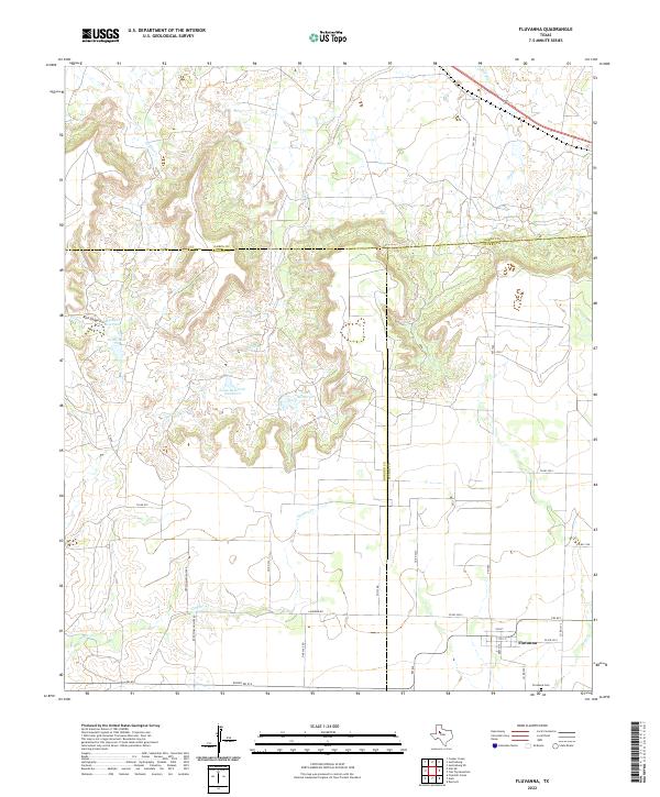
2022 Map of Fluvanna
USGS Topo · Published 2022About this map
Fluvanna sits at the eastern edge of this modern survey, marking a distinct transition point where the flat agricultural plains of the Llano Estacado meet the broken breaks of the Caprock. The landscape is defined by the sharp dendritic drainage patterns of Gopher Cr and Sand Cr, which cut through the terrain as they flow toward the headwaters of the Brazos River system. This transition is underscored by the convergence of three county lines — Garza, Borden, and Scurry — which meet in the rugged breaks north of the settlement.
Find a feature on this map
34 named features on this map. Tap any name to fly to it.
Don’t see what you’re looking for? This feature index may not catch every label — zoom into the map to look around manually.
Map Details
Editions of this 2022 Fluvanna Map
This is the sole edition of this map. No revisions or reprints were ever made.
Other maps of this area

1954 · Dermott
USGS Topo · 1:24,000

1954 · Lubbock
USGS Topo · 1:250,000

1954 · Big Spring
USGS Topo · 1:250,000

1958 · Big Spring
USGS Topo · 1:250,000

1969 · Gail NE
USGS Topo · 1:24,000

1969 · Arah
USGS Topo · 1:24,000

1969 · Justiceburg SE
USGS Topo · 1:24,000

1969 · Fluvanna
USGS Topo · 1:24,000

1969 · Justiceburg
USGS Topo · 1:24,000

1969 · Cooper Creek
USGS Topo · 1:24,000