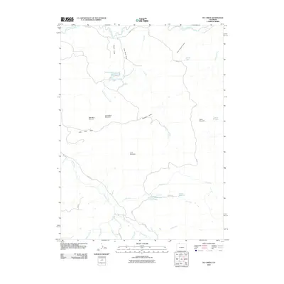
2010 Map of Fly Creek
USGS Topo · Published 2010About this map
The Little Snake River defines the northern boundary of this high-country landscape, where drainage patterns and distinct peaks reveal a remote ranching and grazing environment. Named summits such as Bible Back Mountain, Camel Back Mountain, and Yahoo Mountain punctuate the high ground, while water resources are carefully managed through sites like Larson Reservoir and Slater Creek Lake. The presence of features like Government Corral Creek and Coal Bank Draw reflects the historic agricultural and perhaps early mining activity common to this corner of Routt County. Transport through the area is limited to a network of county roads and Forest Service routes, including County Rd-123 and FSR 116, which connect the various draws and gulches that feed into the larger river systems.
Find a feature on this map
37 named features on this map. Tap any name to fly to it.
Don’t see what you’re looking for? This feature index may not catch every label — zoom into the map to look around manually.
Map Details
Editions of this 2010 Fly Creek Map
This is the sole edition of this map. No revisions or reprints were ever made.
Other maps of this area

1932 · Savery
USGS Topo · 1:96,000

1940 · Savery
USGS Topo · 1:125,000

1954 · Rawlins
USGS Topo · 1:250,000

1954 · Craig
USGS Topo · 1:250,000

1957 · Craig
USGS Topo · 1:250,000

1958 · Rawlins
USGS Topo · 1:250,000

1958 · Craig
USGS Topo · 1:250,000

1960 · Craig
USGS Topo · 1:250,000
1961 · Savery
USGS Topo · 1:24,000

1961 · Grieve Reservoir
USGS Topo · 1:24,000