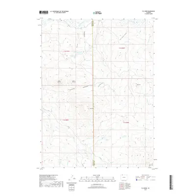
2019 Map of Fly Creek
USGS Topo · Published 2019About this map
The Little Snake River defines the northern edge of this high-elevation landscape along the boundary between Moffat and Routt counties. The topography is marked by several prominent summits, including Bible Back Mtn, Camel Back Mtn, and Yahoo Mtn, which overlook a complex network of seasonal drainages and permanent water sources. The presence of Larson Reservoir and the Grieve Ranch Lower 2 irrigation feature indicates the ongoing importance of water management for livestock and ranching in this part of Colorado. A series of county roads, including Co RD 129 and Co RD 82, provide the primary access through the steep terrain, connecting isolated springs and small bodies of water like Upper Cogdill Lake and Slater Cr Lake. The map reveals a transition from the river bottomlands in the north to the higher reaches of Brush Mtn in the south.
Find a feature on this map
38 named features on this map. Tap any name to fly to it.
Don’t see what you’re looking for? This feature index may not catch every label — zoom into the map to look around manually.
Map Details
Editions of this 2019 Fly Creek Map
This is the sole edition of this map. No revisions or reprints were ever made.
Other maps of this area

1932 · Savery
USGS Topo · 1:96,000

1940 · Savery
USGS Topo · 1:125,000

1954 · Rawlins
USGS Topo · 1:250,000

1954 · Craig
USGS Topo · 1:250,000

1957 · Craig
USGS Topo · 1:250,000

1958 · Rawlins
USGS Topo · 1:250,000

1958 · Craig
USGS Topo · 1:250,000

1960 · Craig
USGS Topo · 1:250,000
1961 · Savery
USGS Topo · 1:24,000

1961 · Grieve Reservoir
USGS Topo · 1:24,000