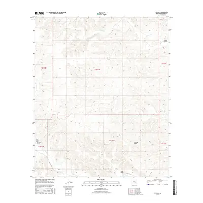
2017 Map of Flying H
USGS Topo · Published 2017About this map
Flying H serves as a primary reference point in this corner of Chaves County, situated near the winding course of the Rio Felix. The landscape is defined by an intricate network of drainages and named relief features, including Squaw Canyon, Cherry Canyon, and Salt House Canyon. Transportation in this rural New Mexico setting is facilitated by Felix Canyon Rd, which parallels the river valley. The presence of the Flying H Ranch Airport underscores the logistical needs of remote ranching operations in the region. Water remains a critical element of the geography, with Crooked Cr and Squaw Cr carving distinct paths through the terrain. This survey reflects the modern configuration of property and public land divisions within the Township and Range system.
Find a feature on this map
18 named features on this map. Tap any name to fly to it.
Don’t see what you’re looking for? This feature index may not catch every label — zoom into the map to look around manually.
Map Details
Editions of this 2017 Flying H Map
This is the sole edition of this map. No revisions or reprints were ever made.
Other maps of this area

1954 · Carlsbad
USGS Topo · 1:250,000

1955 · Roswell
USGS Topo · 1:250,000

1958 · Carlsbad
USGS Topo · 1:250,000

1958 · Roswell
USGS Topo · 1:250,000

1960 · Teel Ranch
USGS Topo · 1:62,500

1961 · Flying H
USGS Topo · 1:62,500

1961 · Indian Bluff
USGS Topo · 1:62,500

1962 · Roswell
USGS Topo · 1:250,000

1962 · Dunken
USGS Topo · 1:62,500

1978 · Artesia
USGS Topo · 1:100,000